Industries
Business Distribution by Industry in Libertów
| Industry Description | Number of Establishments |
|---|---|
| Car repair | 16 |
| Shopping | 10 |
| Construction of buildings | 8 |
| Wholesale of construction supplies | 8 |
| Grocery stores and supermarkets | 8 |
| Real estate | 8 |
| General contractors | 7 |
| Health and medical | 7 |
| Buses and trains | 7 |
| Corporate management | 5 |
| Hardware store | 5 |
Libertów Facts
| Area Codes | 12 |
| Neighborhoods | Swoszowice, Prądnik Czerwony |
| Local Time | |
| Timezone | Central European Summer Time |
| Lat & Lng | 49.97242, 19.89461 |
Map of Libertów
Interactive Map
Area Codes
Percentage Area Codes used by businesses in Libertów
Recent Nearby Earthquakes
Magnitude 3.0 and greater
| Date▼ | Time↕ | Magnitude↕ | Distance↕ | Depth↕ | Location↕ | Link |
|---|---|---|---|---|---|---|
| 11/17/15 | 11:28 PM | 4.1 | 49.9 km | 6,060 m | 3km N of Chelmek, Poland | usgs.gov |
| 11/19/08 | 12:45 AM | 3.2 | 66 km | 1,000 m | Poland | usgs.gov |
| 2/23/08 | 6:32 PM | 3.1 | 72.9 km | 5,000 m | Poland | usgs.gov |
| 2/14/08 | 3:49 PM | 3.1 | 63 km | 5,000 m | Poland | usgs.gov |
| 1/16/08 | 10:21 AM | 3 | 53.3 km | 5,000 m | Poland | usgs.gov |
| 5/4/07 | 3:42 PM | 3 | 60.8 km | 5,000 m | Poland | usgs.gov |
| 12/16/06 | 2:30 AM | 3.2 | 63.3 km | 5,000 m | Poland | usgs.gov |
| 6/25/06 | 1:12 AM | 3.1 | 81.9 km | 5,000 m | Slovakia | usgs.gov |
| 12/19/05 | 2:32 AM | 3.2 | 69.3 km | 1,000 m | Poland | usgs.gov |
| 6/28/05 | 12:35 PM | 3.3 | 53.3 km | 5,000 m | Poland | usgs.gov |
Source: U.S. Geological Survey (USGS)
Libertów
Libertów [liˈbɛrtuf] is a village in the administrative district of Gmina Mogilany, within Kraków County, Lesser Poland Voivodeship, in southern Poland. It lies approximately 12 km (7 mi) south of the regional capital Kraków. village has a populatio..
Libertów Wikipedia Page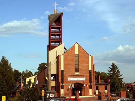

About Our Data
The data on this page is estimated using a number of publicly available tools and resources. It is provided without warranty, and could contain inaccuracies. Use at your own risk.