Morne Fortune Facts
| Local Time | |
| Timezone | Atlantic Standard Time |
| Lat & Lng | 13.99502, -60.99772 |
Map of Morne Fortune
Interactive Map
Recent Nearby Earthquakes
Magnitude 3.0 and greater
| Date▼ | Time↕ | Magnitude↕ | Distance↕ | Depth↕ | Location↕ | Link |
|---|---|---|---|---|---|---|
| 7/24/19 | 5:05 PM | 3.1 | 24.2 km | 33,510 m | 21km NW of Gros Islet, Saint Lucia | usgs.gov |
| 7/27/18 | 1:02 AM | 4.2 | 53.7 km | 157,690 m | 7km SSW of Les Trois-Ilets, Martinique | usgs.gov |
| 5/14/15 | 2:16 PM | 4.6 | 59.4 km | 61,330 m | 48km ENE of Dennery, Saint Lucia | usgs.gov |
| 4/9/14 | 8:50 PM | 4.6 | 63.5 km | 84,350 m | 34km ESE of Le Marin, Martinique | usgs.gov |
| 2/9/14 | 10:54 AM | 4.3 | 61.3 km | 16,800 m | 21km ESE of Le Vauclin, Martinique | usgs.gov |
| 12/27/12 | 11:34 PM | 3.9 | 56.4 km | 67,100 m | Saint Lucia region, Windward Islands | usgs.gov |
| 3/4/12 | 1:25 AM | 4 | 26.4 km | 119,500 m | Saint Lucia region, Windward Islands | usgs.gov |
| 11/16/10 | 2:02 PM | 3.3 | 13.9 km | 19,000 m | Saint Lucia region, Windward Islands | usgs.gov |
| 10/28/10 | 12:57 AM | 4 | 47 km | 24,000 m | Saint Lucia region, Windward Islands | usgs.gov |
| 8/31/10 | 2:20 PM | 3.6 | 19.3 km | 35,000 m | Saint Lucia region, Windward Islands | usgs.gov |
Source: U.S. Geological Survey (USGS)
Morne Fortune
Morne Fortune is a hill and residential area located south of Castries, Saint Lucia in the West Indies. Originally it was a fort constructed by the French, it was captured by the British on 24 May 1796. A memorial to the Royal Inniskilling Fusiliers ..
Morne Fortune Wikipedia Page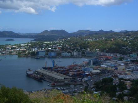


About Our Data
The data on this page is estimated using a number of publicly available tools and resources. It is provided without warranty, and could contain inaccuracies. Use at your own risk.