Industries
Business Distribution by Industry in Kangpokpi
| Industry Description | Number of Establishments |
|---|---|
| Churches | 13 |
| Education | 13 |
| Shopping | 11 |
| Apartments | 10 |
| Hotels and motels | 9 |
| Travel and transportation | 9 |
| Hospitals | 7 |
| Restaurants | 6 |
| Other accommodation | 6 |
| Playground | 6 |
| Construction of houses | 5 |
| Pharmacies and drug stores | 5 |
Kangpokpi Facts
| Neighborhoods | Ward Number 8 |
| Local Time | |
| Timezone | India Standard Time |
| Lat & Lng | 25.15273, 93.97167 |
Map of Kangpokpi
Interactive Map
Area Codes
Percentage Area Codes used by businesses in Kangpokpi
Recent Nearby Earthquakes
Magnitude 3.0 and greater
| Date▼ | Time↕ | Magnitude↕ | Distance↕ | Depth↕ | Location↕ | Link |
|---|---|---|---|---|---|---|
| 7/13/19 | 3:08 PM | 4.3 | 78.5 km | 71,280 m | 69km ENE of Yairipok, India | usgs.gov |
| 4/4/19 | 7:45 AM | 5.1 | 56 km | 61,780 m | 25km SSW of Phek, India | usgs.gov |
| 2/3/19 | 5:20 PM | 4.5 | 70.3 km | 66,280 m | 10km S of Mayang Imphal, India | usgs.gov |
| 1/27/19 | 11:45 PM | 4.7 | 83.2 km | 65,340 m | 9km SSE of Kakching, India | usgs.gov |
| 1/27/19 | 4:49 AM | 4.7 | 51 km | 67,970 m | 28km ENE of Yairipok, India | usgs.gov |
| 6/20/18 | 7:44 AM | 4.5 | 72.8 km | 67,380 m | 31km ESE of Yairipok, India | usgs.gov |
| 3/15/18 | 2:26 AM | 4.5 | 90.4 km | 55,550 m | 14km NW of Churachandpur, India | usgs.gov |
| 2/18/18 | 8:33 PM | 4.1 | 79.9 km | 49,300 m | 33km ESE of Yairipok, India | usgs.gov |
| 10/3/17 | 1:48 PM | 4.5 | 77.9 km | 77,480 m | 73km SSE of Phek, India | usgs.gov |
| 6/18/17 | 10:35 PM | 4.6 | 57.8 km | 21,470 m | 4km W of Thoubal, India | usgs.gov |
Source: U.S. Geological Survey (USGS)
Kangpokpi
Kanggui, also known as Kangpokpi, is the principal town of Sadar Hills under Sadar Hills Autonomous District Council in Manipur state of India. The town is well connected with the state capital Imphal through National Highway-39 and it also connect T..
Kangpokpi Wikipedia Page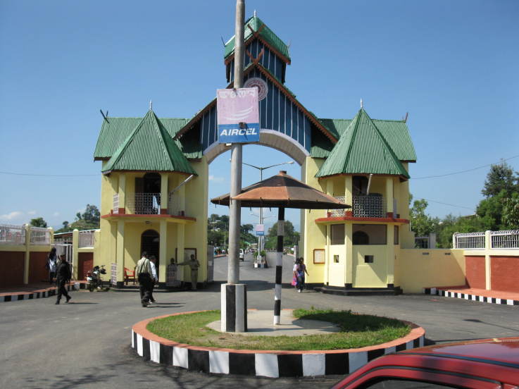


About Our Data
The data on this page is estimated using a number of publicly available tools and resources. It is provided without warranty, and could contain inaccuracies. Use at your own risk.