Categories in Bromyard
Auto Parts StoreCar repairCar Repair and MaintenanceNew car dealersBlacksmithDairy FarmFarmingIndustrial & Construction ManufacturingFabric StoreChurchesPost OfficeShipping and Mailing ServiceShipping ServiceArchitectsCarpenterConstruction of buildingsConstruction of housesElectricianEngineerHome Repair ContractorHousing DevelopmentMechanical EngineerPainting and paint contractorsPlumbing installation and repairHorse Riding SchoolPrimary SchoolArtistPhotographerTourist AttractionWebsite DesignerBakeriesBars, pubs and tavernsButcherCafesPubRestaurantsFurniture storesLandscaperAccountantBanksCemeteryNursing HomeBeauty salonsHairdresserHair SalonBusiness CenterManagement Consultant FirmHoliday ApartmentRv parkConvenience stores
Showing 1-50 of 67
Industries
Business Distribution by Industry in Bromyard
| Industry Description | Number of Establishments | Average Age of Business |
|---|---|---|
| Tractors and farm equipment | 67 | — |
| Corporate management | 39 | 27 years |
| Shopping | 37 | 29 years |
| Shopping other | 35 | — |
| Restaurants | 25 | — |
| Other accommodation | 24 | — |
| All food and beverage | 21 | — |
| Grocery stores and supermarkets | 20 | — |
| Health and medical | 19 | — |
| Car repair | 18 | 20 years |
| General contractors | 16 | — |
| Construction of buildings | 13 | — |
| Churches | 13 | — |
Map of Bromyard
Interactive Map
Neighborhoods in Bromyard
Percentage of businesses by neighborhood in Bromyard
Area Codes
Percentage Area Codes used by businesses in Bromyard
Price Distribution
Business distribution by price for Bromyard
Recent Nearby Earthquakes
Magnitude 3.0 and greater
| Date▼ | Time↕ | Magnitude↕ | Distance↕ | Depth↕ | Location↕ | Link |
|---|---|---|---|---|---|---|
| 10/26/08 | 6:06 PM | 3.9 | 2.4 km | 9,300 m | England, United Kingdom | usgs.gov |
| 11/30/07 | 10:05 PM | 3.3 | 91.5 km | 12,000 m | Wales, United Kingdom | usgs.gov |
| 9/23/02 | 3:32 AM | 3.2 | 44.8 km | 9,300 m | England, United Kingdom | usgs.gov |
| 9/22/02 | 11:53 PM | 4.8 | 44.1 km | 9,400 m | England, United Kingdom | usgs.gov |
| 6/20/02 | 5:26 PM | 3.4 | 79.8 km | 14,300 m | Wales-England region, United Kingdom | usgs.gov |
| 2/12/02 | 7:13 PM | 3.5 | 74.9 km | 8,300 m | Wales-England region, United Kingdom | usgs.gov |
| 1/28/02 | 12:30 AM | 3 | 76 km | 10,000 m | Wales-England region, United Kingdom | usgs.gov |
| 10/10/01 | 2:52 AM | 3.5 | 85.7 km | 10,000 m | Wales-England region, United Kingdom | usgs.gov |
| 9/23/00 | 4:23 AM | 4 | 62.2 km | 13,100 m | England, United Kingdom | usgs.gov |
| 10/25/99 | 7:15 PM | 4.5 | 81 km | 10,000 m | Wales-England region, United Kingdom | usgs.gov |
Source: U.S. Geological Survey (USGS)
Bromyard
is a market town in Herefordshire, England, situated in the valley of the River Frome. The latest census gives a population in 2011 of approximately 4,500. It lies near to the county border with Worcestershire on the A44 between Leominster and Worc..
Bromyard Wikipedia Page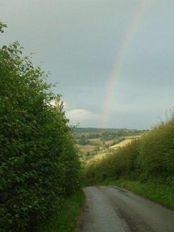


About Our Data
The data on this page is estimated using a number of publicly available tools and resources. It is provided without warranty, and could contain inaccuracies. Use at your own risk.